Hiking and biking the Minnesota Valley State Recreation Area
We visited the Minnesota Valley State Recreation Area near Jordan on a hot July day, wanting a good hike, some river views, and easy access from the center of Minneapolis/St. Paul.
The park features hiking, biking and equestrian trails, picnic areas, a nicely marked Hiking Club Trail, and a handful of walk in camp sites. The nominal state recreation area is divided into five “units” and roughly follows the Minnesota Valley State Trail from east of Shakopee more than 28 miles to Jordan along the Minnesota River. The part of the trail that starts in Shakopee is paved and provides about a nine mile bike route from a point east of Shakopee to Chaska. The rest of the trail is unpaved and is marked for “multi-use.” However, based on the trail we hiked in the western Lawrence Unit, if you’re going to bike it, be sure your equipment is of the sturdy trail bike variety.
Some posts on MN Trips may contain affiliate links. If you buy something through one of those links, we may earn a small commission. As an Amazon associate, we earn from qualifying purchases.
There is also a bikeable part of the area that is disconnected from the rest of the trail. That part is east of 35W and north of the river in Bloomington. The paved path there takes you to the River Bottoms area. You get to it by taking the 106th Street exit off 35W, then taking Lyndale Avenue south from there.
The bit of the recreation area that’s recommended for hiking is the western most Lawrence Area. Drive to the parking lot at the hiking trail head which includes a visitor center, picnic area, parking and toilets. (Use this Google map to get you to the right place. The signage along the road is a little confusing.)
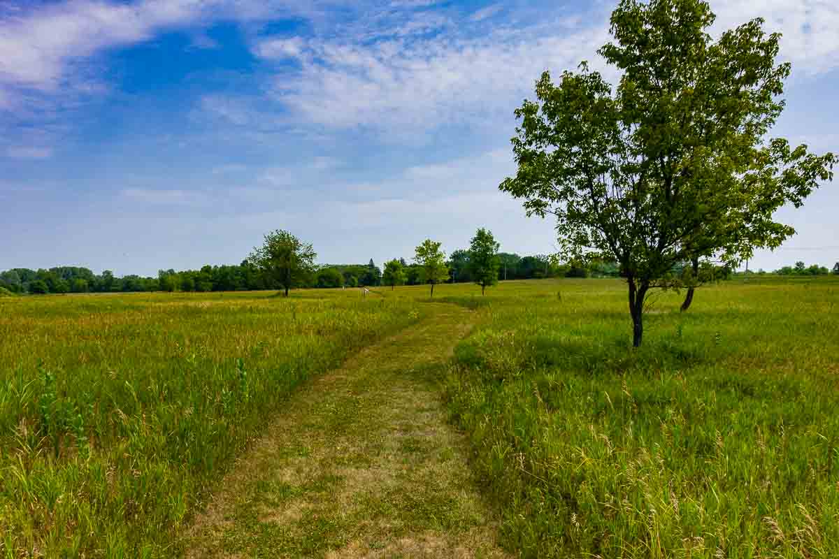
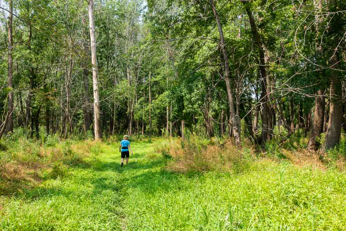
Once we found the trail head, we set out, unintentionally, on a trail that quickly crossed to the south side of the road, opposite the Minnesota River. (We went to the right as you face the visitor center. The Hiking Club trail goes off to the left.) Though we considered backtracking to catch the Hiking Club trail, we decided to embrace this section. The mowed path wound through woods and higher prairie land, giving us loads of close-up looks at birds, butterflies, dragonflies and other insects, plus an assortment of hardwood trees and healthy clumps of sumac, dogwood, and cattails. (You might want to check the Avenza maps download before setting out if you want to be sure you’re on the right path. Best idea: get the Avenza app on your phone.)
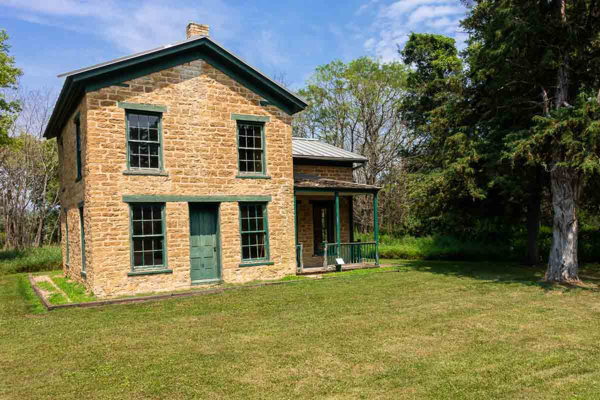
This trail took us east where we met up with the Hiking Club trail, but not before stopping for a look at the Samuel B. Strait House, a 1857 brick home built when the planning was at full throttle for a new river town, to be named St. Lawrence. The home is now administered by the Scott Country Historical Society but rarely open. (Don’t trust the website as to opening hours. It said the house is open Fridays. It wasn’t.) Still, peering in the windows and reading the signs outside will provide a fair amount of context.
From here we took to the Hiking Club trail that first loops back to the north to meet the State Trail and curves back west along the river. The State Trail, at least on this occasion, wasn’t nearly as well maintained as the Hiking Club sections, so we abandoned thoughts of biking from here across the connecting river valley trails to other parks–without trading up to mountain bikes, at least.
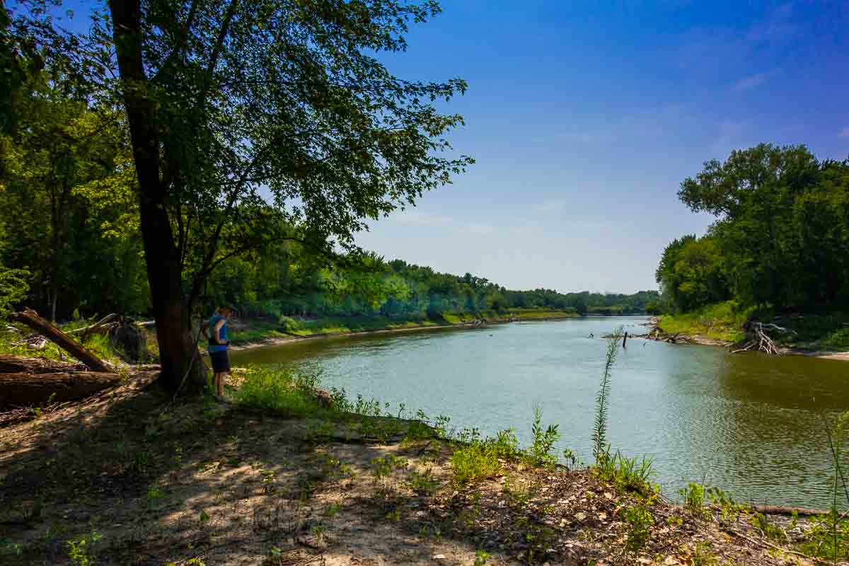
At any rate, the grass was deeper, the trail less traveled, and the natural berm created from decades of spring river floods and changing currents shielded us from any views of the Minnesota River. At one point, Kris impatiently headed through grass up to her armpits to climb the riverbank for a look. It was hardly worth it.
But later, approaching the last section leading to the car park, we re-entered the woods. The underbrush cleared, the ground grew sandy, and we found lots of interesting signs of the Minnesota River and its habitat: water fowl, songbirds, signs of beaver, telltale log jams tossed well above the water and dozens of yards back from the bank. We were constantly reminded of the river’s highs and lows.
Eventually we came out at a lookout on the river where it takes a horseshoe bend. Heron and jumping fish stood out against the high and dry riverbanks on display in this drought year. To make it even more bleak, an abandoned motorboat sprinkled with broken glass and a few beer cans was beached below us.
So the hike was better than the views. The abundant butterflies were a treat, and we imagined winter and cross-country ski trails as we hiked along.

Other treats in the area
Besides getting in our steps on a sweaty day (yes, if we were wise, we’d have gone early in the morning), we found two other highlights nearby:
How many times have you driven by Minnesota’s Largest Candy Store? It’s the big yellow building west of Jordan on Highway 169. The parking lot was full, and we thought we’d mistakenly driven up to a casino from the looks of it. Go in and grab what you want. We stocked up on salt water taffy and some Minnesota made oldies like Pearson Salted Nut Rolls. Buy soda pop singly or as mix and match 6-packs. There are lots of other culinary gifts and supplies, and some wacky illustrated ceilings and backdrops to amuse young and old.
By the time we were done hiking and binging at the candy story, it was 3 p.m. and we hadn’t eaten lunch. We were lucky to walk into the Carasim Coffee Shop on Broadway right next door to the Nicolin Mansion Bed and Breakfast–both on the historic register.
Carasim is a soda fountain, coffee shop, antique store, gift shop, and event center all rolled into one. We enjoyed homemade soup, a burger, and natural fruity ice tea (mango, raspberry, amazingly with no sugar added). A former Jordan mayor sat a few bar stools over, and we chatted about the history of the place with owner Kim Hanner who was handling everything that day.
More info from MNTrips
See the list of all Minnesota State Parks, including basic permit information. We also have a list of all Minnesota Historical Society sites. We’re adding our commentary for the park and historical sites as we visit them.
When you plan on hiking or biking the Minnesota State Parks and recreation areas, be sure to download the Avenza Maps app to your phone. The app allows you to download the trail maps for almost every state park, and they are invaluable for navigation, especially because many of the parks don’t have as many directional signs as they should.
Also, if you’re planning on camping at Minnesota State Parks, you’ll need a reservation. Here’s the online reservation form.
Check out our recommendations for what to carry in your hiking day pack when you check out the extensive Minnesota State Park and National Park system.
Some of the links on this page may be affiliate links, which means we may receive a small commission if purchases are made through those links. This adds no cost to our readers and helps us keep our site up and running. Our reputation is our most important asset, which is why we only provide completely honest and unbiased recommendations.

- Things to Do in Red Wing, Minnesota - December 3, 2023
- Best Things to Do in St. Cloud - March 13, 2023
- Granite Falls: Minnesota River Town - June 8, 2022