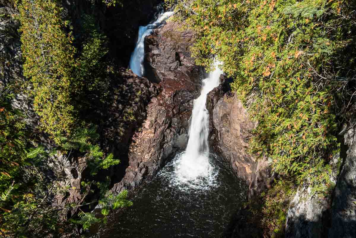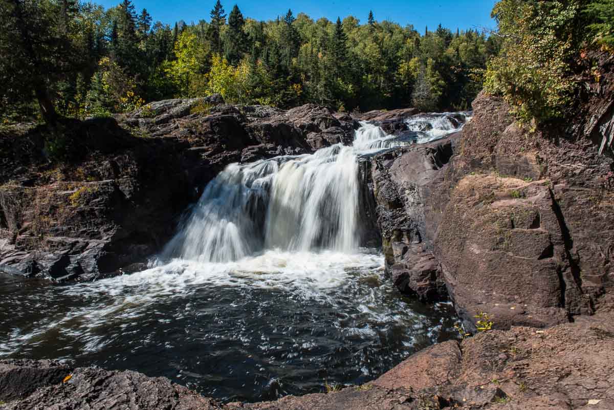
It’s one of the great geological mysteries of Minnesota. The Brule River runs through the Judge C.R. Magney State Park until it encounters a rock outcropping and splits into two waterfalls. The water from the east side of the rock continues down the river, but the waterfall on west side of the rock falls into a pothole and…disappears into the Devil’s Kettle.
The Devil’s Kettle is just about a mile and a half from the north shore of Lake Superior, just a few miles south of the U.S.-Canada border, 14 miles up Highway 61 from Grand Marais. For years, it was thought that the water poured into the fissure somehow emerged via some magical tunnel to the bottom of Lake Superior. That was the theory anyway after attempts to trace the flow by tossing everything from ping pong balls to logs into the Kettle proved fruitless.
Some posts on MN Trips may contain affiliate links. If you buy something through one of those links, we may earn a small commission. As an Amazon associate, we earn from qualifying purchases.
But the extremely powerful system, it is thought, destroys anything tossed into the plunge pool. The powerful recirculating system is capable of holding any material under the pool below the kettle until it’s disintegrated into unrecognizable bits by the time the water resurfaces at some point downstream.

But eventually science and logic came to the rescue. In 2017, the Minnesota Department of Natural Resources measured the water flow above the falls at 123 cubic feet per second and below the falls at 121 cubic feet per second. The DNR determined the flows to be practically identical. In other words, the water that enters the hole is somehow re-emerging in the river downstream.
A dye test was contemplated to prove this hypothesis, but was cancelled because it was felt the water volume measurement was in itself conclusive.
Oh, and don’t try the dye experiment yourself. A permit is needed for that sort of test, and it’s unlikely that you’d get one.
Hiking to the Devil’s Kettle
It’s an uphill hike of a bit more than a mile from the Judge C.R. Magney parking lot to the falls overlook. Just below the Kettle is another small falls you can go down a long flight of around 180 stairs to see.
The smaller falls are, by Devil’s Kettle standards, nothing special. And if you go down to see them, you’re going to have to climb back up those 180 steps to get back up to the trail. And right after that climb, there’s another 70 steps to get you up to the viewing spot of the Devil’s Kettle.

Note: the trail to the falls in Judge C.R. Magney State Park is part of the Superior Hiking Trail that runs all the way from the Canadian Border to south of Duluth. The Superior Hiking Trail runs through most of the state parks that line the North Shore and is part of the North Country National Scenic Trail that runs across the northern United States from Vermont to North Dakota.
You can see all my posts from my latest trip to the North Shore here.
See our list of other waterfalls along the North Shore of Minnesota.
More info from MNTrips
See the list of all Minnesota State Parks, including basic permit information. We also have a list of all Minnesota Historical Society sites. We’re adding our commentary for the park and historical sites as we visit them.
When you plan on hiking or biking the Minnesota State Parks, be sure to download the Avenza Maps app to your phone. The app allows you to download the trail maps for almost every state park, and they are invaluable for navigation, especially because many of the parks don’t have as many directional signs as they should.
Also, if you’re planning on camping at Minnesota State Parks, you’ll need a reservation. Here’s the online reservation form.
Check out our recommendations for what to carry in your hiking day pack when you check out the extensive Minnesota State Park and National Park system.
- Birding in Winnipeg - June 24, 2023
- 12 Museums to Visit in the Twin Cities - March 21, 2023
- Crosby Manitou State Park: A Tough Hike - July 27, 2022


Put me down for a NO on the invitation to a 180 foot death climb. My hiking in BWCA involved humping back packs and canoes.
My soul resides in that region.
Oh, it’s not THAT bad.
And what if someone does illegally the dye test and publishes it all in Internet??
What are they gonna do about that?
What’s the risk? A fine? 4chan mobs resolved trickier puzzles than that(Shia LaBeouf peace flag)… Come on, They dried up the US Niagara Falls in 1969, they just diverted by building a coffer dam! so in this case with a bunch of big bags of sand that would be largely enough. They cancelled the test because the measurements confirmed it??? Let me laugh, mi guess is they just don’t want the mistery being explained from scratch to empiric cristal clear data with precise locations because that place attracts tourism because of that ” mystery”.
They won’t allow or do a dye test because it would disprove their obvious false hypothesis. What other logical reason would there be for not going forward?
I guess I don’t understand why the University would be interested in not really finding out what’s going on. Maybe the expense? Maybe because dye might somehow be injurious to the eco system? Also, I haven’t been up there this summer, but have heard water levels are quite low.