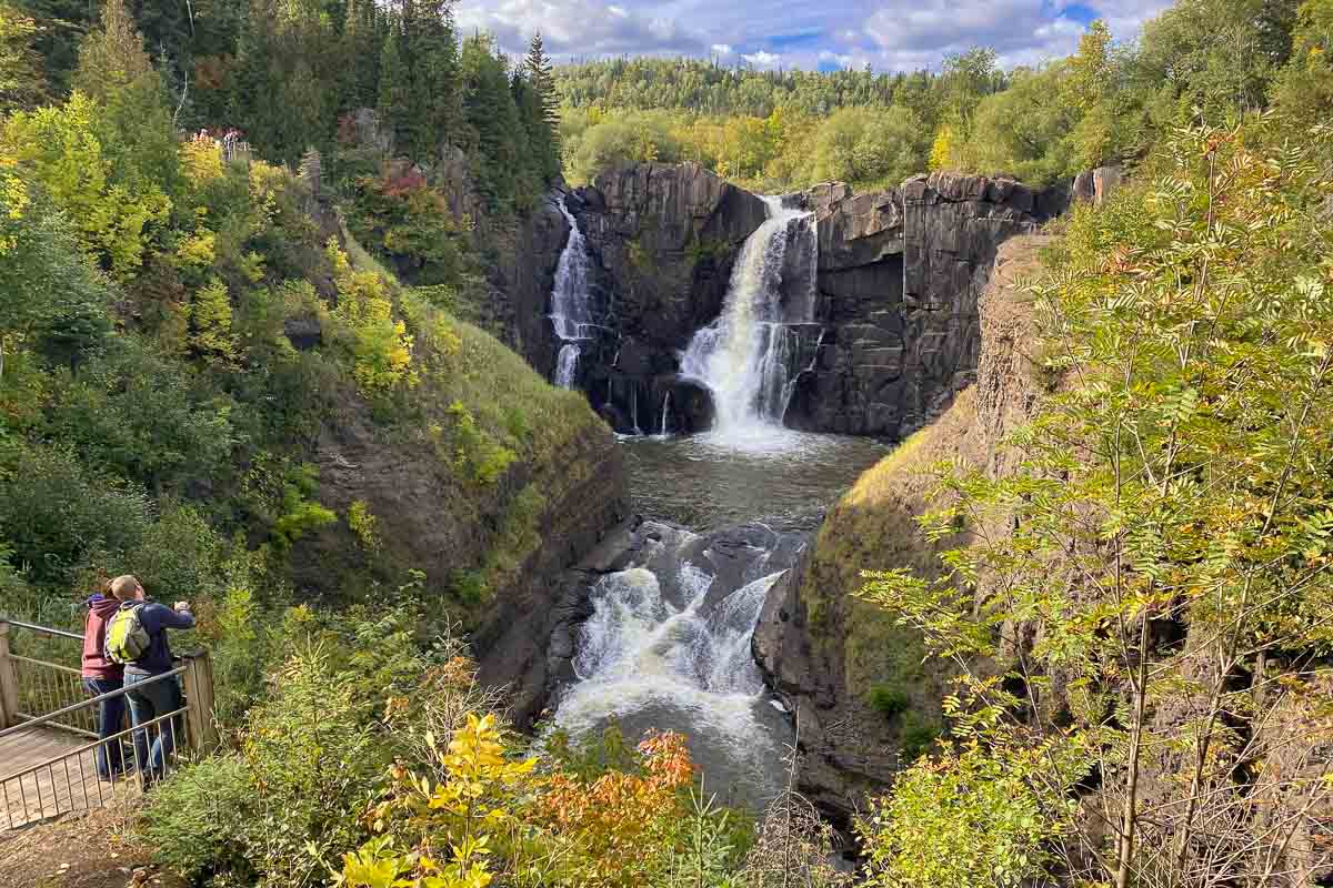
Obviously, the main attraction of Grand Portage State Park is the High Falls of the Pigeon River. These falls, the highest in Minnesota drop 120 feet (37 meters) down the black basalt face. Out of the parking lot just off Highway 61 is an easy half-mile (800 meters) asphalt paved hiking trail that leads to a section of boardwalk and three viewing platforms giving different angles on the falls. The first and third platforms are up some stairs, but the middle one is accessible to wheelchairs, a rarity in the state parks.
The only alternative (or add on,) to the High Falls hike is a 4.5 mile (7.3 kilometer) round trip trail up river to the Middle Falls. From the the high ground at the end of the trail, you’ll get views up the Pigeon River Valley and down to Lake Superior. The trail passes through the land of the Anishinabe Nation (the Grand Portage Band of the Chippewa.) The park was established in 1989 as a cooperative effort between the Anishinabe people and the State of Minnesota. The visitor center contains exhibits on Anishinabe culture, as well as serving as a Minnesota tourism information center. When the border with Canada is open, it’s the first encounter tourists from Canada have with the state.
Some posts on MN Trips may contain affiliate links. If you buy something through one of those links, we may earn a small commission. As an Amazon associate, we earn from qualifying purchases.
The Grand Portage State Park is odd among the Minnesota State Parks for a couple of reasons: there are no camping facilities, and it’s the only one that doesn’t require a permit to drive into. In fact, it’s also designated as a highway rest stop. Also, this is the only state park not owned by the State of Minnesota. The land is leased from the Bureau of Indian Affairs (BIA) which holds it in trust for the Grand Portage Band.
The High Falls, and many other waterfalls and rapids along the last stretch of the Pigeon River, are what gave the site its Grand Portage name. Early traders had to carry their cargoes overland for the last 8.5 miles to the Superior shore because the river could not be navigated by canoe. The actual end point of the Grand Portage was at the trading post at what is now the Grand Portage National Monument, which is six miles back down Highway 61.
If you like, you can make that original Grand Portage hike today. The trail head is at the National Monument site and goes that 8.5 miles (13.7 kilometers) to the site of Fort Charlotte.
You can see all my posts from my latest trip to the North Shore here.
See our list of other waterfalls along the North Shore of Minnesota.
More info from MNTrips
<!—MNTrips state parks copy—>See the list of all Minnesota State Parks, including basic permit information. We also have a list of all Minnesota Historical Society sites. We’re adding our commentary for the park and historical sites as we visit them.
When you plan on hiking or biking the Minnesota State Parks, be sure to download the Avenza Maps app to your phone. The app allows you to download the trail maps for almost every state park, and they are invaluable for navigation, especially because many of the parks don’t have as many directional signs as they should.
Also, if you’re planning on camping at Minnesota State Parks, you’ll need a reservation. Here’s the online reservation form.
Check out our recommendations for what to carry in your hiking day pack when you check out the extensive Minnesota State Park and National Park system.
Some of the links on this page may be affiliate links, which means we may receive a small commission if purchases are made through those links. This adds no cost to our readers and helps us keep our site up and running. Our reputation is our most important asset, which is why we only provide completely honest and unbiased recommendations.
- Birding in Winnipeg - June 24, 2023
- 12 Museums to Visit in the Twin Cities - March 21, 2023
- Crosby Manitou State Park: A Tough Hike - July 27, 2022

