I was driving from the Twin Cities to spend several days on the North Shore and stopped short of Duluth to make my first visit to Jay Cooke State Park on the St. Louis River.
The St. Louis River is the largest tributary of Lake Superior in the United States. The rocky terrain, the rushing water, and the dramatic colors of fall made for some, dare I say, iconic Minnesota landscapes.
Some posts on MN Trips may contain affiliate links. If you buy something through one of those links, we may earn a small commission. As an Amazon associate, we earn from qualifying purchases.
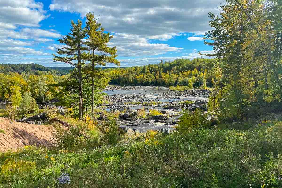
My introduction to Jay Cooke was just that. I was gazing at the scenery as I drove into the park and completely missed the turnoff from the highway into the visitors center. About a mile past the turnoff I passed over a tall bridge and saw the landscape you see pictured above off to my right. I pulled the car over to the side of the road and walked down a steep path beneath the bridge which led all the way to the water’s edge.
It was obvious the path was barely, if at all, maintained, and had been made by hundreds of people like me who had been struck by the expansive tableau of the classic beauty of Minnesota and had been drawn down to the river to get a closer look. (If you like, you can find the head of the Ogantz Trail on the map which will take you to an overlook of the river valley from Oldenburg Point.)
After my foray under the bridge, and after figuring out that I’d overshot the visitors center, I headed back that way to settle on a hike for the day.
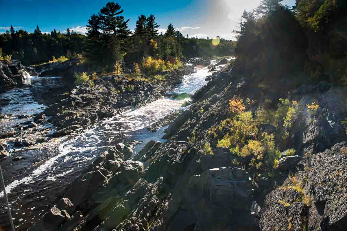
From the visitors center, and after a brief chat with the always helpful state staff, I chose to to the Silver Creek Trail. The Silver Creek trail starts out with a walk across the Saint Louis River on the so-called Swinging Bridge, where you can stop for photos up and down river. (Don’t dally too long. Because of Covid restrictions, only one party is allowed on the bridge at a time. Don’t make others who want to cross wait too long.) The Swinging Bridge, btw, is a reconstruction of the original Civilian Construction Corps bridge built in the 1930s. The original was wiped out by floods in 1950 and 2012. The reconstructed bridge was raised 7.5 feet to protect it from future flooding.
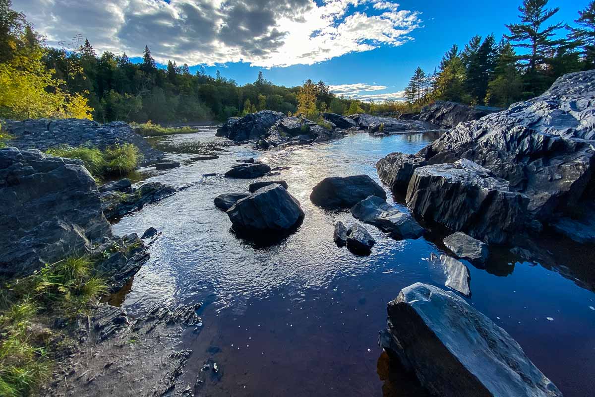
At the end of the bridge, take an immediate left, clamber up a few rocks and you’ll find yourself on the Silver Creek Trail. The trail follows the river down stream for about a mile, although you’ll be above the water with limited views. If you want, there’s a little side trail that leaves the main trail soon after you start. It’s the “River Trail” and will take you on a short loop at river level before leading you back up to the main Silver Creek Trail.
The trail takes a turn away from the river after about a mile and leads into a birch and basswood forest that displays fall golds and crimsons and an abundance of wild flowers before eventually looping back to the river and the bridge. At the end of the loop, you have the opportunity to step off the trail and get right down to the level of the rocky river rapids. There are various spots there to get some nice photos.
The North Country National Scenic Trail, the hiking trail that stretches from eastern New York to central North Dakota, passes through the park. The Silver Creek Hiking Trail includes some of the Superior Hiking Trail and the North Country National Scenic Trail. The North Country National Scenic Trail is part of the U.S. National Park System in Minnesota.
Overall, the park has more than 50 miles of hiking trails. Several feature scenic views over the Saint Louis River. Some trail–the Greely Creek Trail, Triangle Trail, and Gill Creek Trail, are open to mountain biking. The Willard Munger State Trail also runs through the park. On the Munger trail, you can bike to Duluth, about 15 miles (24 km) away. The trail features views of the Duluth harbor.
One of the park’s paths follows an old Indian and fur trader portage route. The gorge of the Saint Louis River was not navigable to canoes, so the Ojibwe created a 6.5-mile (10.5 km) portage around it. Later, the voyageurs used it and called it the “Grand Portage of the St. Louis.”
There are two dams on the Saint Louis River near the park; the Thomson Dam (near the northwest boundary) and the Fond du Lac Dam (near the northeast boundary). You can see the gorge below the Thomson Dam, and the historic Thomson Cemetery if you take the Thomson trail to the west from the Visitor Center parking area about 1.5 miles.
You can view or download a map of Jay Cooke State Park here.
Jay Cooke State Park was established in 1915 when the St. Louis River Power Company donated 2,350 acres of land that were not needed for power generation. In 1945, the state purchased additional land and has added more land over the years to get the park to its present size of 8,125 acres.
So, who was Jay Cooke and why is there a park named for him? He was a 19th Century financier, railroad tycoon, and brick fabricator who saw the power generating potential of the Saint Louis River. There’s more info on his connection to Minnesota and the Duluth area in a five minute audio presentation from the Minnesota Parks.
See our list of other waterfalls along the North Shore of Minnesota.
More info from MNTrips
See the list of all Minnesota State Parks, including basic permit information. We also have a list of all Minnesota Historical Society sites. We’re adding our commentary for the park and historical sites as we visit them.
When you plan on hiking or biking the Minnesota State Parks, be sure to download the Avenza Maps app to your phone. The app allows you to download the trail maps for almost every state park, and they are invaluable for navigation, especially because many of the parks don’t have as many directional signs as they should.
Also, if you’re planning on camping at Minnesota State Parks, you’ll need a reservation. Here’s the online reservation form.
Check out our recommendations for what to carry in your hiking day pack when you check out the extensive Minnesota State Park and National Park system.
Some of the links on this page may be affiliate links, which means we may receive a small commission if purchases are made through those links. This adds no cost to our readers and helps us keep our site up and running. Our reputation is our most important asset, which is why we only provide completely honest and unbiased recommendations.
- Birding in Winnipeg - June 24, 2023
- 12 Museums to Visit in the Twin Cities - March 21, 2023
- Crosby Manitou State Park: A Tough Hike - July 27, 2022