
There’s no shortage of soothing walks in the Twin Cities. The plethora of parks due to the wisdom of the early city fathers in setting aside all the land bordering the river and lakes means you can always take a waterside walk or bike ride without being bothered by cars.
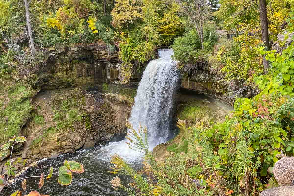
But, there’s an urban walk in Minneapolis that will quickly make you forget you’re even in a city. That walk starts right at Minnehaha Falls in south Minneapolis. You can park at Minnehaha Park right near the waterfall, walk past the local favorite Sea Salt restaurant to a stone wall where you can lean over to have a look at the cascade. Next, walk a few yards to your left and then down a couple flights of stairs to Minnehaha Creek level and start following the Creek to the east.
Some posts on MN Trips may contain affiliate links. If you buy something through one of those links, we may earn a small commission. As an Amazon associate, we earn from qualifying purchases.
You’ll have to cross a bridge right away to the south side trail and follow that side for a couple hundred yards before you’ll you’ll want to take the opportunity to cross the next bridge and get back on the north side.
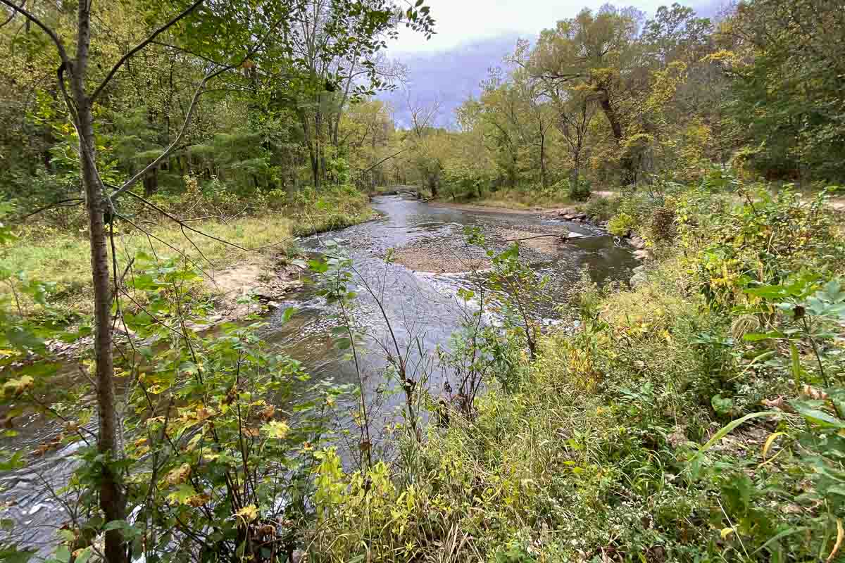
After that, as you walk east, you have the option to cross the Creek on one of the many bridges. Beware though, because the path on the south side of the Creek is usually quite a bit lower than the one on the north, and can be muddy if there have been recent rains. Other than the part near the falls, I pretty much stuck to the north side.
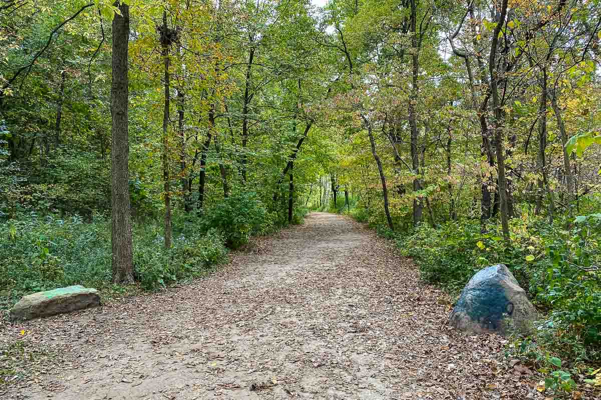
The walk down Minnehaha Creek is just a little more than a mile and it’s a very easy time. There are no rocks to climb or steep inclines in either direction. So, it can be a great walk for children, too.
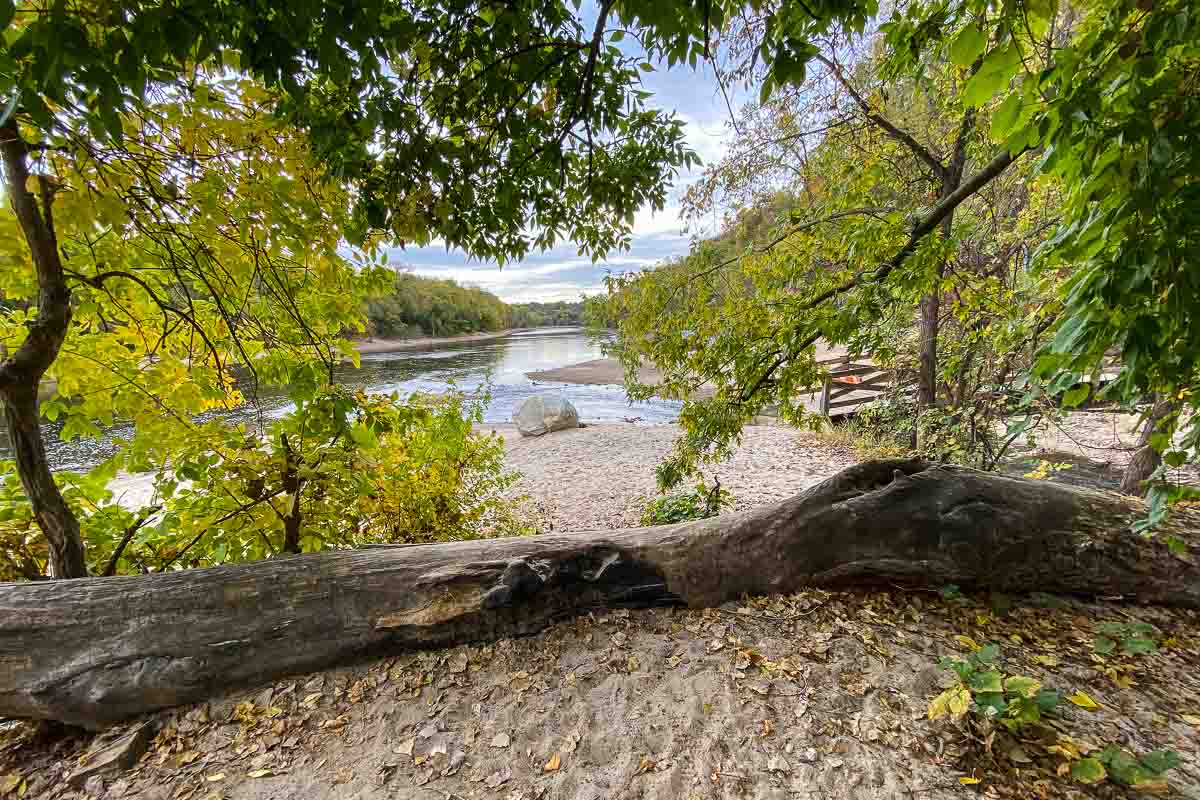
After that mile, you’ll get to a sandy beach where you can walk right down to the Mississippi River right in front of you. At the end of the walk you realize you’ve been in a part of the city where no part of the city is actually visible. It’s a woodsy, quiet river overlook, except for the gurgle of the water. Also, you won’t run into too many other walkers.
The round trip from the parking lot to the river and back should take less than an hour, which is good because you have to get back before your parking fee expires. I made it with eight minutes to spare.
The Minnehaha Falls and the Creek below the falls are just a small section of the route of the Minnehaha Parkway that runs the entire way from the western border of Minneapolis to the Mississippi on the east. The part below the Falls I’ve described above is the only really “wild” part, but the rest of it is very bike and pedestrian friendly. Where there isn’t a dedicated bike path along the Parkway, there are well marked bike lanes. The Parkway is the east-west connection of the Minneapolis Grand Rounds that circle all the lakes on the west side of the city. The Minnehaha Parkway section of the Grand Rounds is 12 miles long.
Minnehaha Park is one of the regional parks administered by the Minneapolis Park and Recreation Board.
The Minnehaha Falls and Minnehaha Creek area is considered part of the Mississippi National River and Recreation Area, managed by the U.S. National Park System.
Some other hikes you can take in the Twin Cities metro area include Fort Snelling State Park, Winchell Trail Minneapolis Westwood Hills Nature Center, and Afton State Park.
And here are a lot more ideas of what to do in Minneapolis and Saint Paul.
More info from MNTrips
See the list of all Minnesota State Parks, including basic permit information. We also have a list of all Minnesota Historical Society sites. We’re adding our commentary for the park and historical sites as we visit them.
When you plan on hiking or biking the Minnesota State Parks, be sure to download the Avenza Maps app to your phone. The app allows you to download the trail maps for almost every state park, and they are invaluable for navigation, especially because many of the parks don’t have as many directional signs as they should.
Also, if you’re planning on camping at Minnesota State Parks, you’ll need a reservation. Here’s the online reservation form.
Check out our recommendations for what to carry in your hiking day pack when you check out the extensive Minnesota State Park and National Park system.
Some of the links on this page may be affiliate links, which means we may receive a small commission if purchases are made through those links. This adds no cost to our readers and helps us keep our site up and running. Our reputation is our most important asset, which is why we only provide completely honest and unbiased recommendations.

- Birding in Winnipeg - June 24, 2023
- 12 Museums to Visit in the Twin Cities - March 21, 2023
- Crosby Manitou State Park: A Tough Hike - July 27, 2022
Nature at its very best in this state. I love that first photo with the photograph and the stunning visuals of the change of colors. It’s amazing!
It’s a lovely spot and the start of a nice walk to the big river.
We love visiting and exploring Minnesota. Since we have family in the 10,000 Lakes state, you will often find us there. 2020 has curtailed some of our adventures, but we hope to make up for it next year. We will definitely have to check out Minnehaha Falls.
It’s the starting point for a wonderful hike.
I enjoyed reading this description and viewing the images of the walk to Minnehaha Falls almost as much as if I’d taken it! The description would be especially helpful when planning to take this walk. I’m looking forward to one day actually enjoying it in person.
Lots to do in Minneapolis, including the dozens of interesting walks.