
Note: this post has been updated slightly because, as of May 2022, the Fort Snelling Historical Site and the attendant visitor center is now open to the public. Also take note, springtime flooding of the Mississippi River may have inundated some of the park’s hiking paths discussed here. Be sure to check current status of the paths before planning your visit. While some of Fort Snelling State Park is flooded, you might consider an alternative walk around the nearby Coldwater Spring historic site.
Fort Snelling State Park is a day hiker’s paradise, with at least three hiking routes out of the main parking lot that lead to interesting conclusions. You can take a mile and a half round trip visit the historic fort itself (when it’s open.) You can take a short hike of about a mile round trip out to the spot where a small channel of the Minnesota meets the Mississippi at the west end of Pike Island. And, you can take a three-mile circumnavigation of Pike Island following the main channel of the Minnesota River along the south side of the island to where it meets the Mississippi at the east end of the island. From there, follow the path back along the north side of the island along the Mississippi back to your starting point.
Some posts on MN Trips may contain affiliate links. If you buy something through one of those links, we may earn a small commission. As an Amazon associate, we earn from qualifying purchases.
Historic Fort Snelling
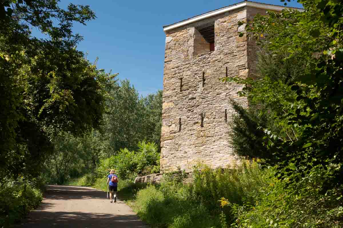
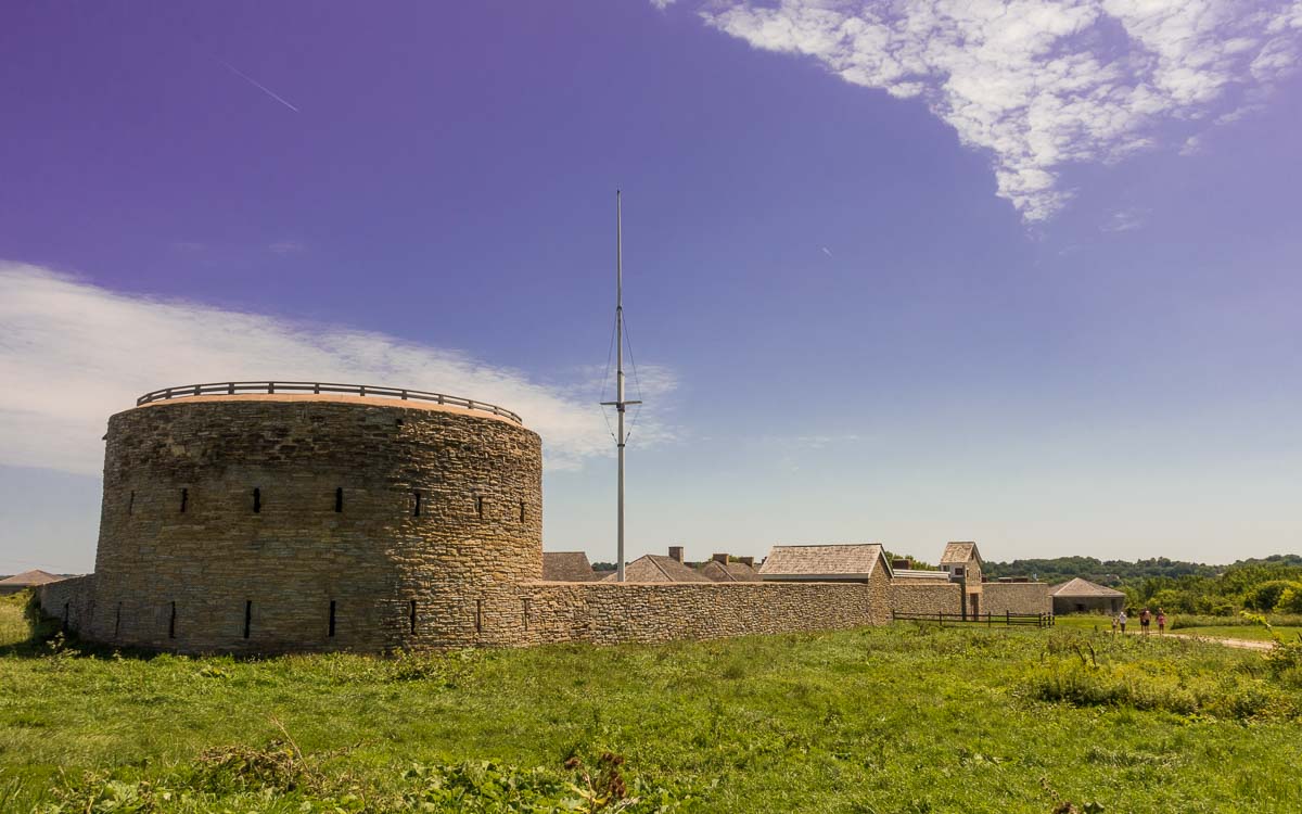
The walk up to the historic Fort Snelling is, since its reopening in May 2022 after extensive renovations and the opening of the attendant museum, worth the hike. The fort site itself is managed by the Minnesota Historical Society.
But even when the fort site is not open, you can still walk around the walls and admire them and the chapel from the outside. There are several placards that give a bit of information about the fort, but they’re minimal. If you have a choice, come between Memorial Day and Labor Day when the Fort is open and provides some context to the outdoor offerings of Fort Snelling State Park.
Now that the fort is open, keep your eye on the MNHS website to plan a visit. Fort Snelling has an important place in Minnesota History and it’s worth learning a bit about it.
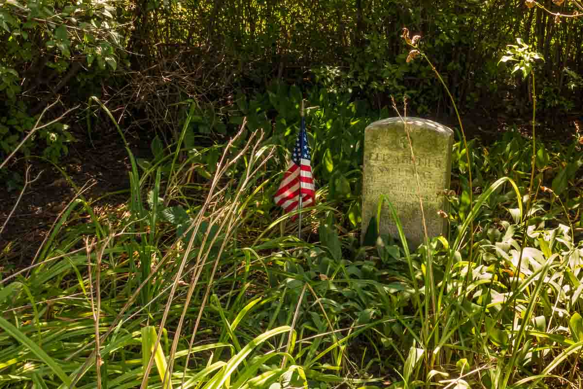
One thing you can see on the outside of the fort site is the grave of Elizabeth Snelling, the first white child born in Minnesota in September 1820. She died 13 months later. The headstone was actually placed in 1926 and the gravesite was moved to the current location in front of the chapel in 1940. But there’s something moving about it, especially because it’s been overtaken by a very small patch of prairie, in contrast to a manicured site you might expect. It sits in an overgrown shady spot that somehow seems more fitting for the grave of an infant.
To the Mississippi
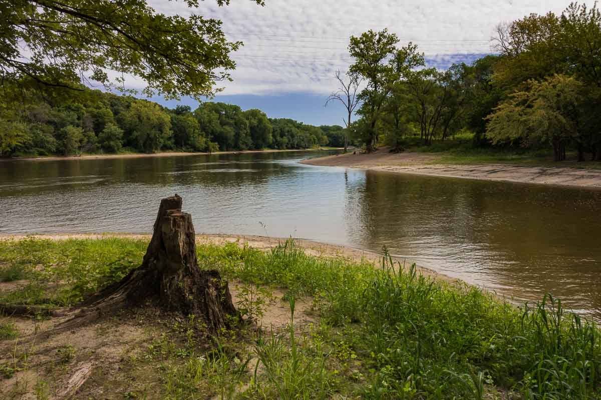
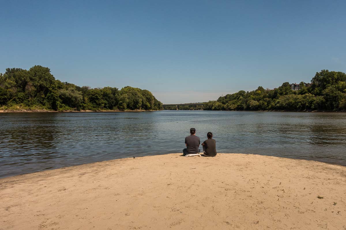
After coming down the hill from the fort, you’ll see a sign with a map of the park. (You probably saw this sign before you walked up to the fort.) As you look at the sign, take the path that leads to your right into a wood. In just a short while, you’ll reach the point where the channel of the Minnesota that runs to the north of Pike Island meets the Mississippi.
It’s a very calm spot and it even seems that the Minnesota at this point is running in the opposite direction. I don’t know why it seems so, but if it is, it defies logic. Perhaps just the small volume of this branch meeting the fast and deep Mississippi leads to the sense of backwater. Or maybe even the flow of the big river is pushing the waters of the Minnesota back where they came from. I’ll have to ask a river expert.
Pike Island
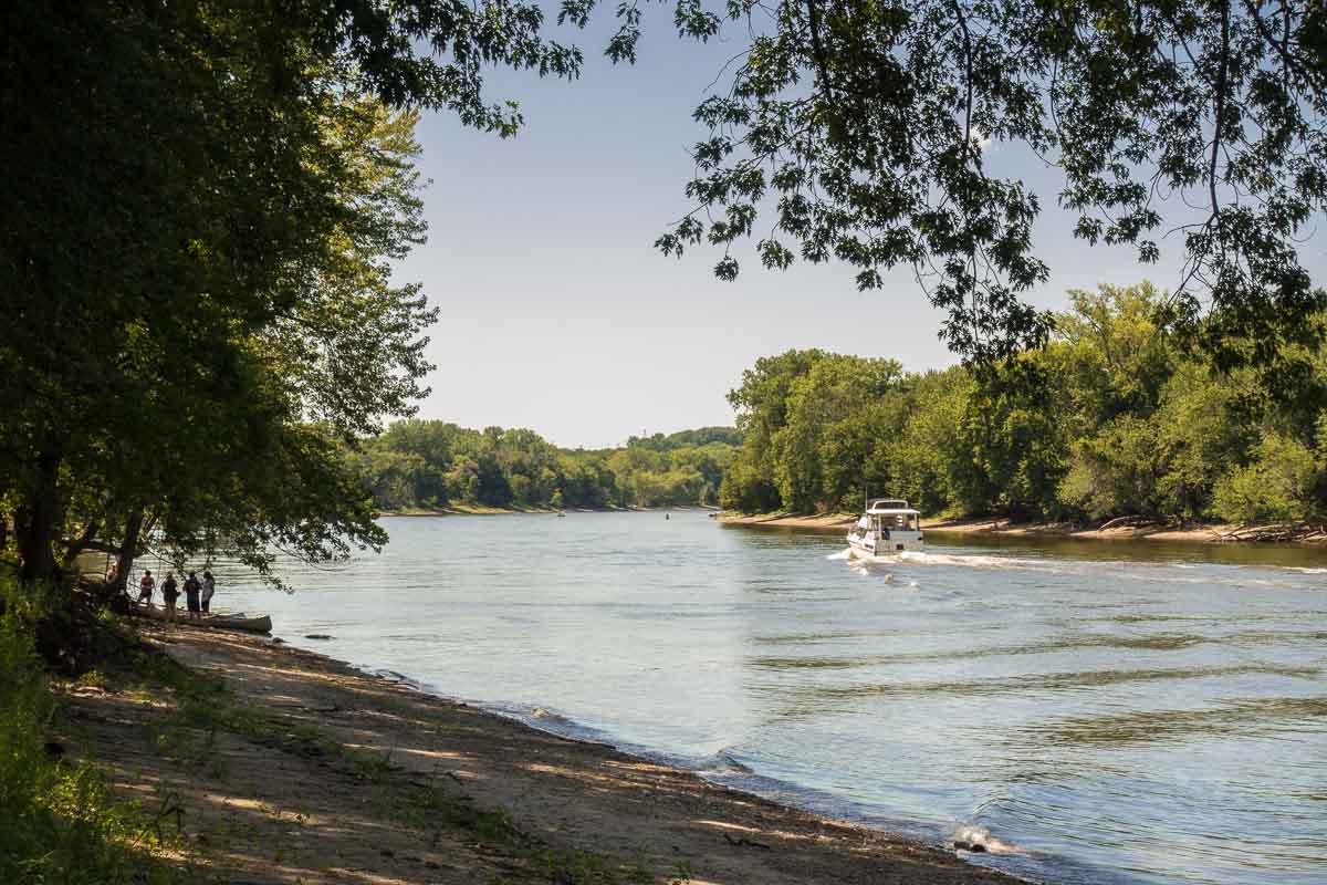
The culmination of the Fort Snelling State Park visit is the hike around Pike Island to the confluence of the main channel of the Minnesota with the Mississippi. Follow the signs and map to a small footbridge that leads to Pike Island. Note: if you’re on a bike, you have to leave it before the bridge. There’s a place to lock it up.
When you cross the bridge to the island, there will be a sign with a map right in front of you, but be careful, it’s a bit confusing. (Minnesota State Parks in general are not the best at signage. They’d do better to have sign posts pointing you in the right direction instead of maps that don’t tell you exactly where you are.)
If you want to walk the Mississippi (north) side first out to the convergence point, no problem. From the sign, just go to your left. The river and path are right there in view and it’s not too hard to figure out.
The problem arises if you want to walk the Minnesota River side first. There’s a path starting just to the right of the map sign that looks like it. Don’t be fooled, like we were. That’s a path right through the middle of the island that is (eventually) marked as a winter ski trail. It will get you to the point of the island, and it’s shady and a nice walk. But, it’s not along the river.
To get to the Minnesota River path, walk the few yards back to the end of the bridge, turn around as if you just stepped off the bridge, and take the path that leads off to your immediate right. That’s the Minnesota River path. As I said, the sign is not clear about that. You’ve been warned.
The hike out to the point of convergence is a three-mile round trip, whichever route you take. The trails are wide and well maintained, which allow you to either dawdle and admire the iconic rivers, or step lively and get the heart rate up.
Either way, Fort Snelling State Park is a beautiful wooded oasis in the middle of the cities. The very thing that makes the Twin Cities so attractive for both urban and outdoor fans.
Note: the park also features a three-mile-long bike and hike path on the other side of the Minnesota River upstream to the southwest. That path is currently (as of August 2020) closed due to river flooding.
Fort Snelling State park is one of four state parks that are easy drives from the Twin Cities. The others are Interstate, Afton, and William O’Brien. All can be reached from the Twin Cities in under an hour.
More info from MNTrips
See the list of all Minnesota State Parks, including basic permit information. We also have a list of all Minnesota Historical Society sites. We’re adding our commentary for the park and historical sites as we visit them.
Check out our recommendations for what to carry in your hiking day pack when you check out the extensive Minnesota State Park and National Park system.
Some of the links on this page are affiliate links, which means we may receive a small commission if purchases are made through those links. This adds no cost to our readers and helps us keep our site up and running. Our reputation is our most important asset, which is why we only provide completely honest and unbiased recommendations.

- Birding in Winnipeg - June 24, 2023
- 12 Museums to Visit in the Twin Cities - March 21, 2023
- Crosby Manitou State Park: A Tough Hike - July 27, 2022