In hindsight, the hike at Afton State park was the first one I’ve taken in a while where I was very glad I had taken my own advice and brought a lot of water with me in my backpack. Two liters was just about right.
Also in hindsight, I’m kicking myself for not checking the heat index before I set out on my longest hike in a while. Turns out, I found out later, it was 96 degrees F (36 C) and, as they say, it was not a dry heat. It never is dry in Minnesota, except in winter.
Some posts on MN Trips may contain affiliate links. If you buy something through one of those links, we may earn a small commission. As an Amazon associate, we earn from qualifying purchases.
But even with that, it was a lovely day.
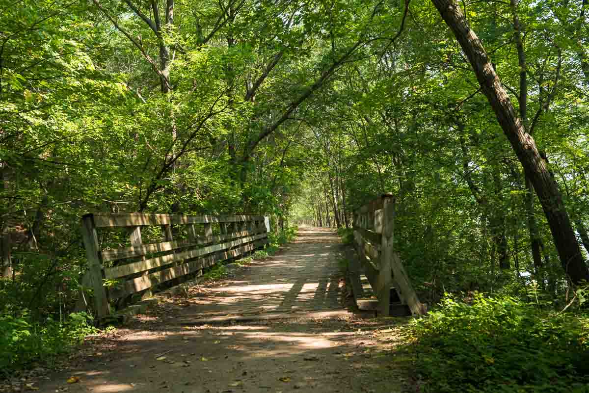
I started out on hiking from Afton’s parking lot down to the river. After getting out of the parking lot area, you come upon a shady picnic area with paths leading off in various directions. I chose first to hike downhill to the St. Croix river path, and then go north along the river.
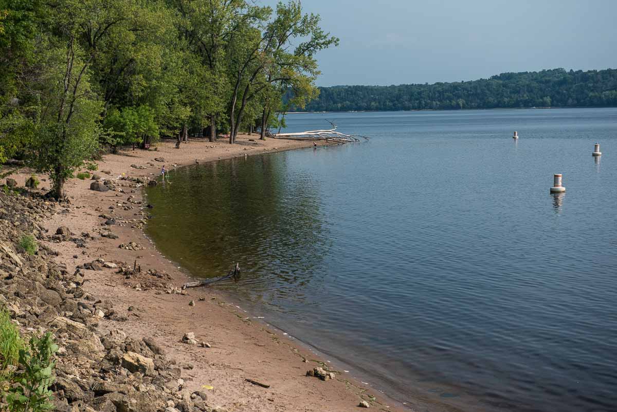
If you’re so inclined there are several spots to turn off the path that runs parallel to the river and actually go down to the water. You can even take a dip in the designated swimming areas. Or, if you brought your canoe or kayak, this is where you can put into the river. Beware though, unlike most Minnesota State Parks, there’s no drive in boat launch. You’ll have to tote your boat down from the parking lot, and that’s probably half a mile away. And when you are done, it’s half a mile back to your car. All uphill. My advice is put in the St. Croix at another park.
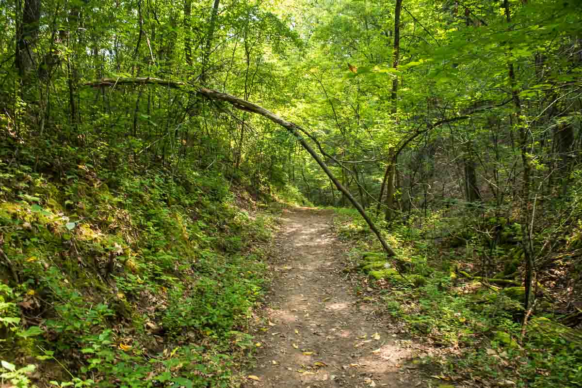
The path along the river, though, is a short one, and if you’re up for a longer, and slightly more challenging and varied hike, Afton has that for you. At the north end of the river path, you turn left and immediately start a rather steep uphill climb. At this point you’re still in the riverside wood so you’re still in the shade–which is welcome because between the exertion of going uphill and the growing heat of the day.
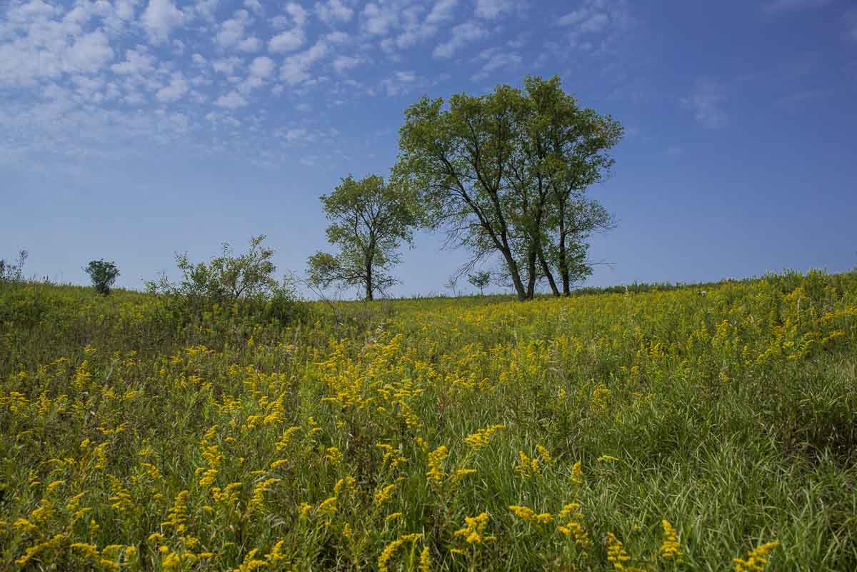
When you make it to the top, you’re leaving the wood and entering some beautiful restored sunny prairie. The first thing that struck me here was not the sun, but the sound. The insects were loud. Literally. and I was immediately reminded of W.B. Yeats’ poem The Lake Isle of Innisfree and his line about the “bee-loud glade.” There were plenty of bees servicing all the prairie flowers at the edge of the path, but in honesty I think most of the noise was being made by crickets.
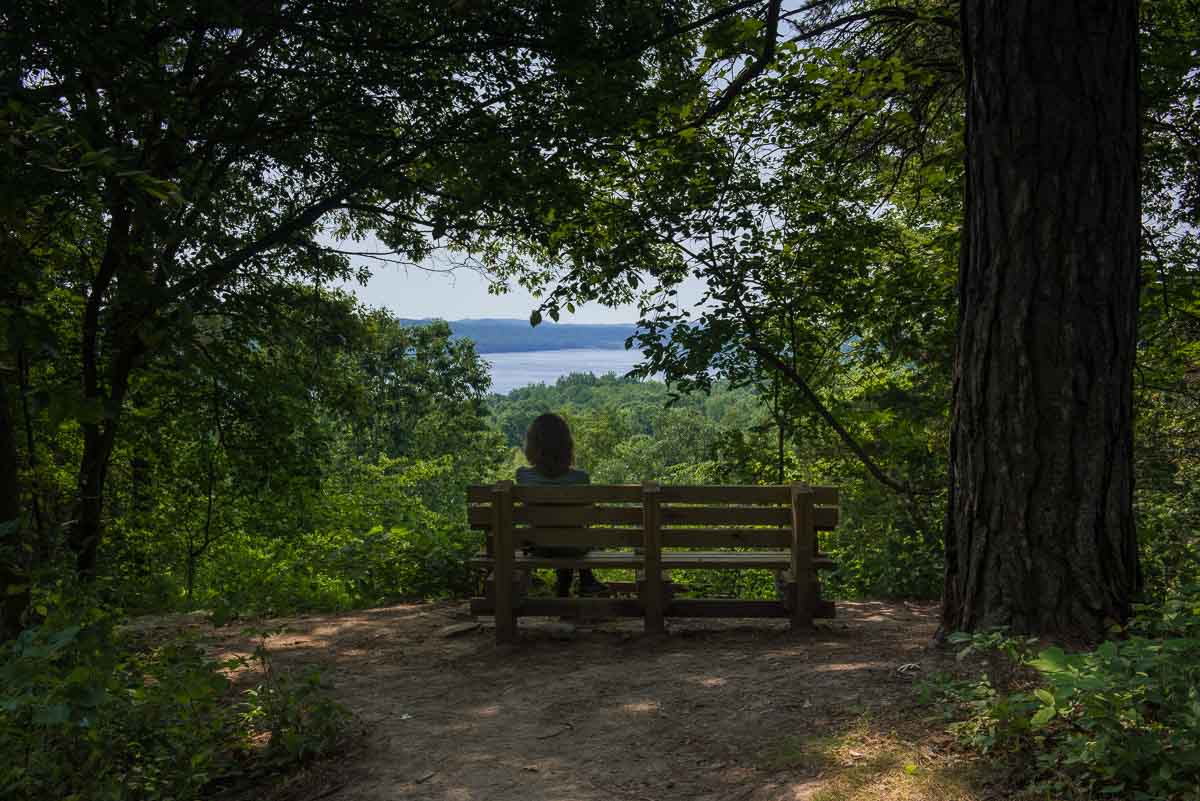
After walking through the prairie for a while, you are presented with the choice of keeping with that landscape, and even climbing higher for a promised overlook of the St. Croix Valley, or descending back into the shady woods and making your way back to the car. I’d planned on doing the former, but the heat turned me back.
I’ll be going back to Afton one day to complete my mission to reach the farthest reaches of the park and hike the entire Prairie Loop, including the Trout Brook loop. It looked so inviting on the map, but in the end, sense prevailed and I headed back down the wooded path to the car.
In most of Minnesota State Parks, the map doesn’t tell you everything you need to find your way around, but of the parks I’ve visited so far, Afton was the best at providing sign posts. At every trail intersection, there was a post with a letter, A, B, C, etc., that corresponded to a spot on your park-provided map. And each path leading off from an intersection had another post that told you which was your next intersection if you took that branch. A great idea that works really well.
Another tip, which I wish I’d had before, is to download the Avenza Map app for your phone and then find the map for the state park you’re visiting. Avenza is an invaluable aid because, once you find the right map, a little blue dot will tell you right where you are, and you can watch your progress as the dot moves with you. For many of the parks which have lousy sign posting, this app is a life saver. I wish I’d had it before I wandered around Wild River State Park for about an hour before I ran across a landmark that got me reoriented.
Afton State Park is one of four state parks that are easy drives from the Twin Cities. The others are Interstate, Fort Snelling, and William O’Brien. All can be reached from the Twin Cities in under an hour.
More info from MNTrips
See the list of all Minnesota State Parks, including basic permit information. We also have a list of all Minnesota Historical Society sites. We’re adding our commentary for the park and historical sites as we visit them.
Check out our recommendations for what to carry in your hiking day pack when you check out the extensive Minnesota State Park and National Park system.
The Saint Croix River, and the Minnesota State Parks that line it, such as Afton, are part of the St. Croix National Scenic Riverway of the US National Park system. Here’s a list of all the US National Park sites in Minnesota.
Some of the links on this page are affiliate links, which means we may receive a small commission if purchases are made through those links. This adds no cost to our readers and helps us keep our site up and running. Our reputation is our most important asset, which is why we only provide completely honest and unbiased recommendations.

- Birding in Winnipeg - June 24, 2023
- 12 Museums to Visit in the Twin Cities - March 21, 2023
- Crosby Manitou State Park: A Tough Hike - July 27, 2022