The first thing that comes to mind when thinking of the Minnesota State Parks along the St. Croix River, such as Interstate State Park near Taylor’s Falls, is access to the river for canoeing, kayaking, and even stand up paddle boarding. (There is a boat launch and canoe rental at the south end of the park.)
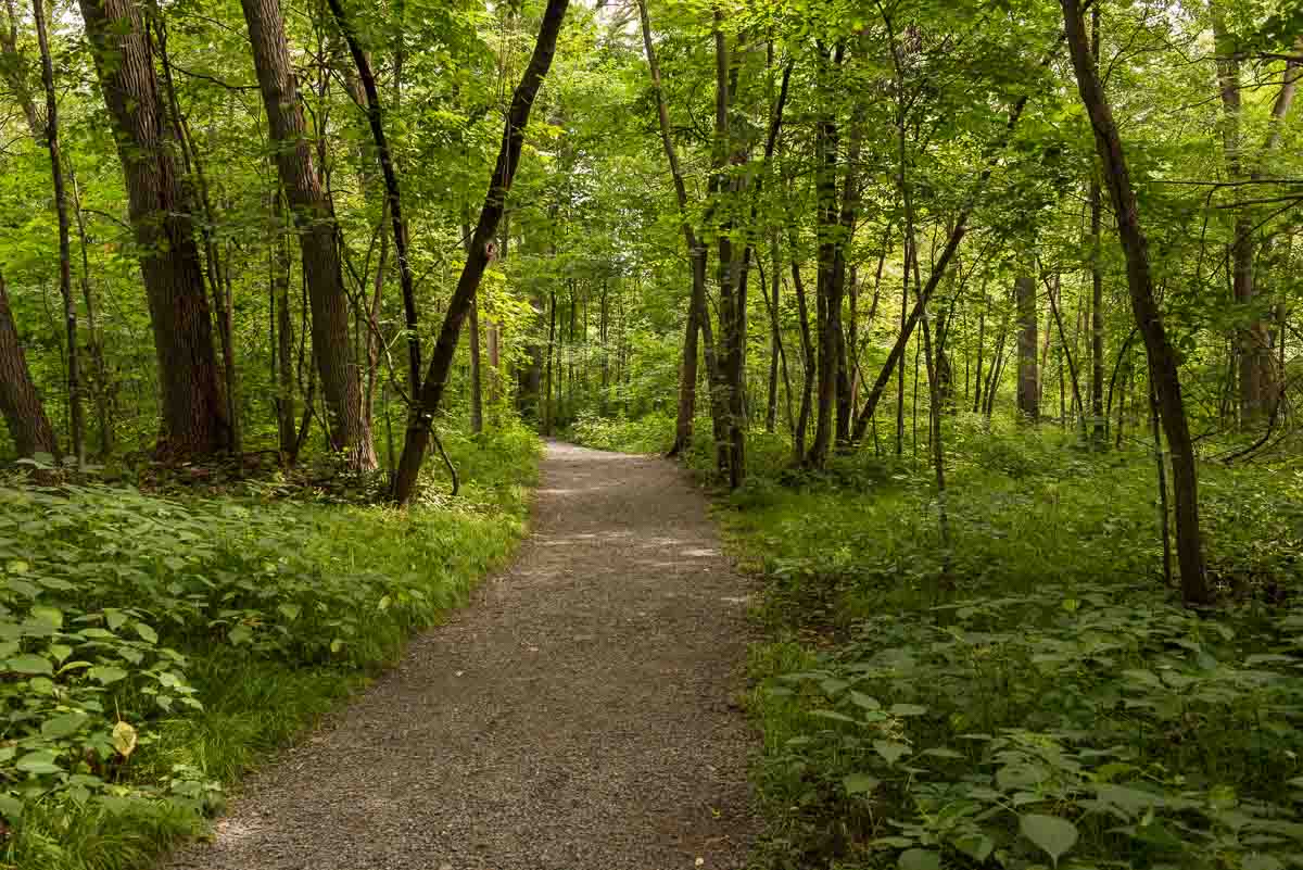
But, Interstate also features two lovely and relatively easy hiking trails that connect the two entrances to the park. So, you can park at either end and traverse the whole park starting from the south (as I did) or starting from the north on the two different paths.
Some posts on MN Trips may contain affiliate links. If you buy something through one of those links, we may earn a small commission. As an Amazon associate, we earn from qualifying purchases.
As I said, there are two trails. the River Trail (obviously) follows near the river and is a bit more rugged. The Railroad Trail returns you to the south end of the park along the old railroad route that runs from the town of Taylors Falls north of the Hwy. 8 and away from the river. Both trails have their attractions.
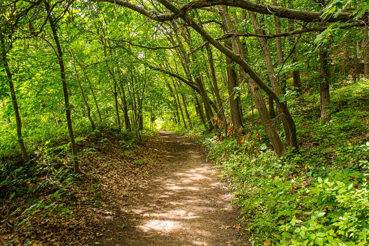
Hiking along the St. Croix River Trail
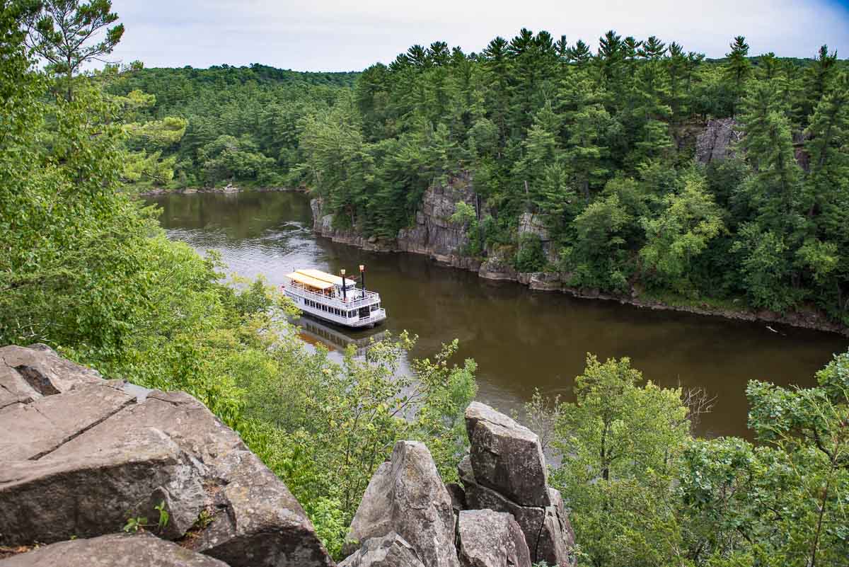
The River Trail starts out level and manicured but quickly turns a bit rocky and rooty and means you’ll have to watch your footing. Especially if there has been some recent rain and things can get slightly slippery. But, in general, it’s an easy route with just a couple of short climbs up some rocky bits. There are several short turn offs toward the river which afford the scenic views of the Dalles of the St. Croix, the steep rock walls that line the river near here. (Click the link to read about the fascinating geology of the St. Croix. Who knew there were volcanoes in Minnesota?)
It will probably take you an hour or so to cover the 1.3 miles (2.1 km) of the River Trail, allowing plenty of time to veer out to the river overlooks to admire the views. Don’t miss the eagles that soar over the river looking for their lunch. You are almost certain to see one.
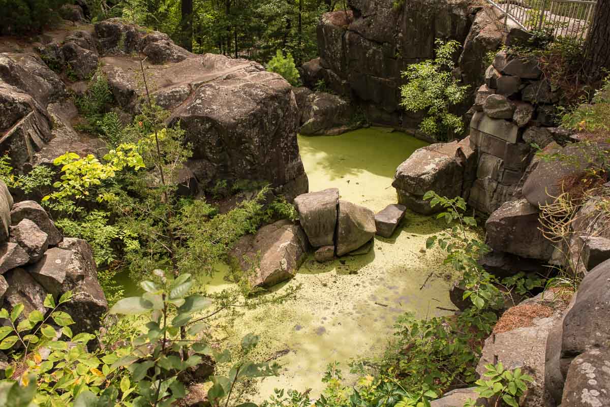
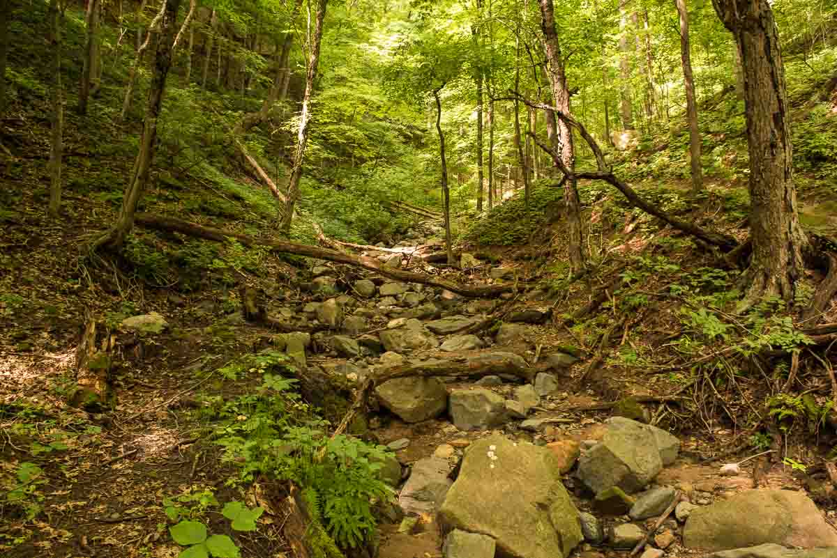
The glacial potholes at the north end of Interstate Park
The River Trail ends at the north entrance parking lot, where you can pick up a winding path through the very interesting geological features of this end of the park: particularly the “potholes.” The potholes, to summarize, were created when the ice sheet of the glacial ages began to melt and the enormous volume of water produced by that melt ran down what is now the St. Croix valley, carving out what you see today. As some of that water was trapped into whirlpools, it carved out the potholes in evidence all along the north end of Interstate Park.
Mostly you’ll follow the path and be able to look down into the holes that give no hint of their depth because they’re currently full of the recent rains. There are more than 400 potholes in the park. Normally, you can even walk down stairs into the Bake Oven Pothole, but it was closed because of flooding when I was there in August 2020.
You can spend another hour or so in the pothole area. It’s certainly more crowded than the River Trail as many visitors seem to come to park in the north entrance lot and limit their park visit to this area.
The Railroad Trail
After exploring the pothole area, you can take a walkway from the north parking lot under Hwy. 8 and into the town of Taylors Falls. Follow the city sidewalks toward the old train depot where you’ll find the entrance to the Railroad Trail headed south. If you like, take a short detour and visit the historic Folsom House not far from the railroad depot. (Note: the Folsom House is currently closed because of Covid-19.)
The first mile or so of the trail is wide and level and you can set a rapid pace if you like and get your heart going. At about the mile mark, you’ll encounter a steep ravine, but the nice park people have provided wooden steps to get you both up and down. I counted about 120 steps down, btw.
If you’re still feeling energetic, just after the ravine is an optional turn off (and another stepped climb) up the one-mile Sandstone Bluffs Trail, for even more dramatic views of the St. Croix valley.
At the end of the Railroad Trail is another underpass under Hwy. 8, at the end of which you’ll find yourself right back in the south parking lot.
Camping at Interstate State Park
There are 37 drive-in camp sites at the park, including 22 with electricity. Check the DNR site for complete information. Advance camping permits are required.
Scenic boat trips
Taylors Falls Scenic Boat Tours operates two paddle wheel boats that ply the river four times daily. The company offers 80-minute cruises at 11 a.m., 1 p.m. and 3 p.m. and a 45-minute trip at 5 p.m. daily. Prices for the longer cruises start at $26.99 for adults ($22.99 if you buy online in advance.) There are discounts for seniors 62+ ($25.99/$21.99) and children 3-12 ($14.99/$13.99.) Trip times can vary daily due to river water levels and other considerations. Check the website or call (651) 465-6315 to be sure before you go.
Canoe rental
You can rent canoes and kayaks at Taylors Falls Canoe located at the south end of he park. From there, you can paddle about seven miles downriver to Osceola and take a shuttle bus back to your car.
Directions to Interstate State Park
From the Twin Cities, take I-35 north to US Hwy 8 East. It takes about an hour by car under normal traffic. Here’s the Google Map link to the park entrance.
Interstate State Park is one of four state parks that are easy drives from the Twin Cities. The others are Fort Snelling, Afton, and William O’Brien. All can be reached from the Twin Cities in under an hour.
More info from MNTrips
See the list of all Minnesota State Parks, including basic permit information. We also have a list of all Minnesota Historical Society sites. We’re adding our commentary for the park and historical sites as we visit them.
When you plan on hiking or biking the Minnesota State Parks, be sure to download the Avenza Maps app to your phone. The app allows you to download the trail maps for almost every state park, and they are invaluable for navigation, especially because many of the parks don’t have as many directional signs as they should.
Also, if you’re planning on camping at Minnesota State Parks, you’ll need a reservation. Here’s the online reservation form.
Check out our recommendations for what to carry in your hiking day pack when you check out the extensive Minnesota State Park and National Park system.
Some of the links on this page may be affiliate links, which means we may receive a small commission if purchases are made through those links. This adds no cost to our readers and helps us keep our site up and running. Our reputation is our most important asset, which is why we only provide completely honest and unbiased recommendations.
The Saint Croix River, and the Minnesota State Parks that line it, are part of the Saint Croix National Scenic Riverway of the US National Park system. Here’s a list of all the US National Park sites in Minnesota.

- Birding in Winnipeg - June 24, 2023
- 12 Museums to Visit in the Twin Cities - March 21, 2023
- Crosby Manitou State Park: A Tough Hike - July 27, 2022