
A brief history of the Sioux uprising
The Minnesota Territory was created by the federal government in 1849, nine years before Minnesota became a state. The original territory was more than twice the size of the current state and encompassed what is now North and South Dakota to the Missouri River. The “problem” though was that white settlers could not legally settle the Territory, as the land belonged to the Dakota (Sioux) Indians. (Note: the Dakota people were called the Sioux by the early French traders. The French had misunderstood the Chippewa derogatory word for their Dakota enemies, Sioux. Sioux means snake in the Chippewa language.)
At the time of the creation of the Territory, the Dakota people were already suffering at the hands of the white people due to the gradual, if illegal, encroachment into their lands, the destruction of the bison, and the interruption of their traditional living patterns.
Some posts on MN Trips may contain affiliate links. If you buy something through one of those links, we may earn a small commission. As an Amazon associate, we earn from qualifying purchases.
In 1851, the Dakota agreed to a treaty with the U.S. ceding most of their land in Minnesota, 24 million acres, except for reservations along the Minnesota River. The Indians, represented by band chiefs Sleepy Eye and Red Iron, met with the territorial representatives, including the first territorial governor Alexander Ramsey, at the town of Traverse des Sioux. The treaty was signed in July 1851. The Indians hoped that by signing a treaty would provide for their survival in the changing environment brought on by the European settlers.
The predictable corruption of the Indian agents, the swindle and theft of the payments due the Indians both in goods and money, and the settlers’ encroachment onto lands that were supposed to be reserved to the bands, finally caused the Indians to revolt. Hostilities commenced with the killing of some settlers in Acton Township on August 17, 1862.
The War lasted less than six weeks. Although the Indians had killed more than 500 soldiers and settlers while only losing around 40 of their own in the first weeks, eventually the U.S. Army and local militias prevailed. The Indians surrendered September 26.
Perfunctory trials were held after the surrender and more than 300 Indians were sentenced to be hanged. Abraham Lincoln himself reduced that number to 39 and he named those to be hanged in his own hand. The letter of condemnation is in the Minnesota History Center.
The final act of the War was the infamous hanging in Mankato of 38 Dakota men on December 26, 1862–still the largest mass execution in United States history. One sentence was commuted at the last minute.
Traverse des Sioux and the Treaty Museum
Traverse des Sioux was a town established in the early 19th Century by European and Indian fur traders on the Minnesota River, about a mile north of where the town of Saint Peter now sits. At this point, the River is relatively shallow and has a firm limestone bottom. The Indians had always used the spot to cross the Minnesota, and so the name: Traverse des Sioux, the Crossing Place of the Dakota. It had always been a meeting place of the various Dakota bands, and so became the logical place to trade with them.
The site of the town of Traverse des Sioux today features trails which follow some of the town’s old streets, but none of the town per se still exists. The site was excavated years ago by the Historical Society, but the prairie was allowed to reclaim the site over the last several years.
You can follow the paths all the way a mile or so down to the river, but I warn you, when you enter the thick wood as you approach the river, the mosquitoes are fierce. Wear long clothes and soak yourself in repellent. I can’t imagine what life was like there before DEET. The trails are open daily from dawn to dusk. They are not maintained in the winter.
You are better off spending your time in the excellent Treaty Site History Center, which is run by the Nicollet County Historical Society.
The History Center’s collection contains thousands of artifacts. photographs, manuscripts, books, and maps. Agricultural implements, toys, dresses, uniforms, musical instruments, sports equipment, furnishings, portraits, and other artifacts are on display. The collected items are available to researchers by appointment.
I had the luck to get a tour of the History Center by docents Steve Hogberg and John Chamberlain, who were, respectively, experts on the 1851 Treaty and the natural history and site’s restoration to native prairie.
Lower Sioux Agency
The Lower Sioux Agency site is managed by the Lower Sioux Indian Community and features a Dakota history exhibit, the restored 1861 US government warehouse building, trails along the Minnesota River, a Museum store featuring Native American books and gifts, and weekend programs on Dakota life and nature. (Be sure to check the website for schedule.)
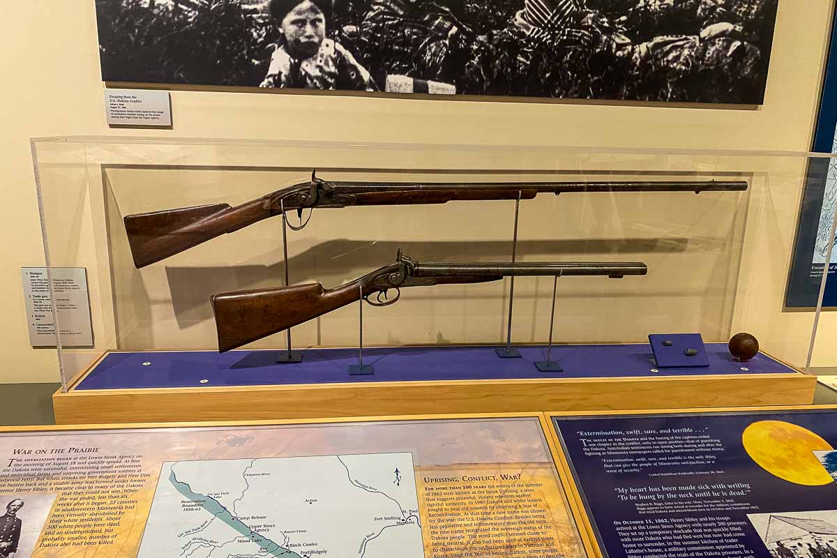
I spent some time in the exhibit room, which offers a good explanation of what went on at the Lower Sioux Agency. It tells the story of how tensions mounted as the US government failed to make payments and provide the food and supplies promised to the Dakota people in the Traverse des Sioux and other treaties.
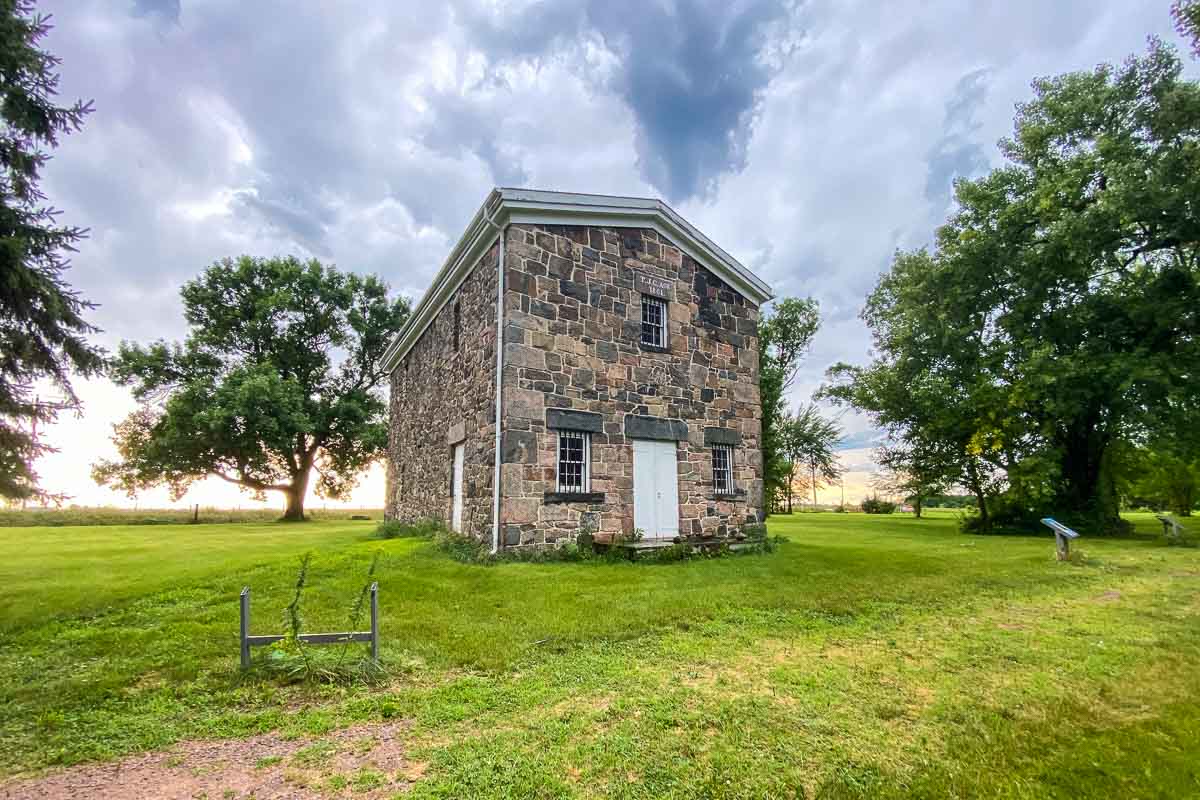
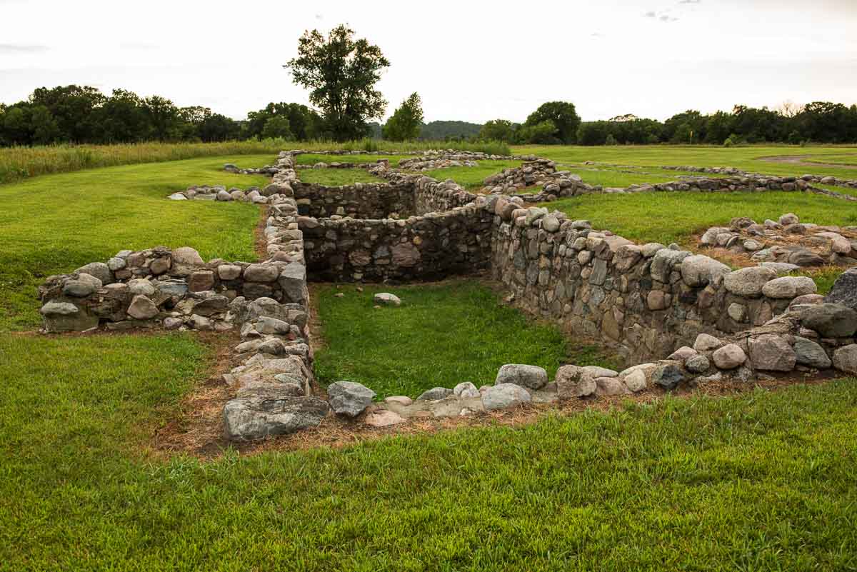
The Lower Sioux Agency was one of two US government Indian agencies established in 1853 to be the administrative centers of the newly created Dakota reservations for the Mdewakanton and Wahpekute bands of Dakota. (The other, the Upper Sioux Agency, is near Granite Falls.) The agencies provided oversight of the Dakota and were to implement federal Indian policy. The Agency had a school, blacksmith shop, stables, carpenter shop, church, boarding house, and homes for agency employees. The only building that still stands is a stone warehouse.
Because of the site’s stated function of distributing money and goods to the Indians, the site was a flashpoint for frustrations. When hostilities broke out, the Agencies were among the first sites to be attacked. Twenty whites were killed at the Lower Sioux Agency on August 18, 1862. Some agency residents escaped across the river due to the heroism of the local ferryman.
A walk around the grounds features placards at the sites of the various buildings, but little to nothing of them remains. So take the opportunity to just make a walk of it, passing the substantial restored warehouse and going down to the river to the ferry site. (Take your insect repellent.)
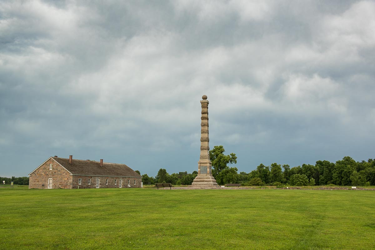
Fort Ridgely
The same year as the Lower and Upper Sioux Agencies were established, the government established Fort Ridgely at the southeastern edge of the reservation.
Fort Ridgely, of course, was an important focus of the Sioux wars. Built at the same time as the Agencies, it was intended to represent the military role in the enforcement of the treaties. It was never anticipated that it would be attacked as a stockade was never constructed. It was also surrounded by woods and ravines which would give any attacker good cover to approach the fort under cover.
Throughout the early days of the conflict, refugees from the Lower Agency and the nearby farms headed into the fort, which was ill prepared for defense as half its garrison that had left to protect the Lower Agency and had been ambushed by the Indians.
But the Fort was given time to prepare for the eventual attack because the Indians decided to attack New Ulm first, in the intervening two days the Fort received reinforcements from militias from Saint Peter and Glencoe and dug in to provide covered gun emplacements.
The Indians finally attacked on August 20 and were repulsed, especially due to the fort’s artillery, which the Indians had never encountered before.
Today, you can walk around the fort and see the stone foundations of the original buildings. The Commissary building has been restored and now serves as the site’s interpretive center. The commissary also includes a museum store where you can purchase books about the history of Fort Ridgely, and other items and souvenirs. Be sure to check the MNHS website before you go for updated information.)
Birch Coolee
A party of soldiers and settlers left from Fort Ridgely on August 31 with the main task of burying people who had been killed by the Indians. They made their way down the Minnesota River to the Lower Sioux Agency site and buried more than 50 settlers and soldiers who had been killed by the Indians in the previous two weeks.
After checking out the abandoned site of Little Crow’s camp south of the river, the commanders concluded the Indians had not been the area for several days, and so made for a camp site near the Birch Coolee ravine. Unfortunately for the burial detail, the Indians were not as remote as they’d hoped, and had seen the detachment leave Little Crow’s campsite and move toward Birch Coolee.
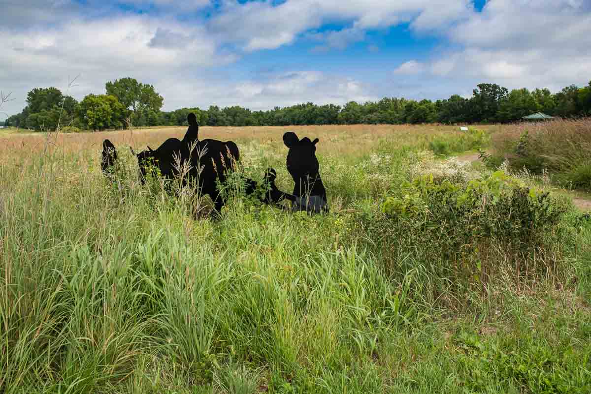
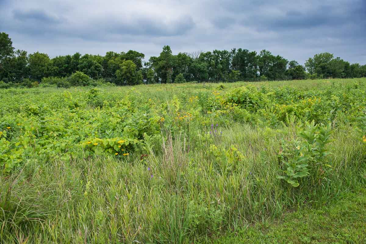
The Birch Coolee battlefield today is said to be not unlike the way it was on September 2, 1862, thick native prairie covering a small rise and flanked by a thick wood to the east that lined the stream bed, the Birch Coolee itself. The Army and settlers group camped in the middle of the prairie, 200 yards from the woods, and with no concern for natural defenses.
The Indians used the cover of the woods and thick prairie–and the incompetence of the inexperienced commanders who neglected to put out pickets at sufficient distance from their camp–to surround the detachment undetected. By dawn on September 2, the Army camp was surrounded on all sides by more than 200 Indians.
When a sentinel noticed an Indian in the nearby grass and fired a shot to warn the camp, it was practically too late. The Indians poured fire into the Army camp and more than 30 soldiers were wounded almost immediately. Most of their horses were also killed, which allowed the soldiers to use the horses’ bodies as cover and return fire.
The battle continued for hours until an Army force from Fort Ridgely arrived the next day and lifted the siege. The relief force found that 13 soldiers had been killed and more than 50 had been wounded, and nearly all the horses had been killed.
It became even more apparent after the battle that the Indians could not be defeated by the largely volunteer, untrained, forces that had been facing them to date.
The battle site today features pathways that lead you to markers that show you where the various Indian groups and white forces were at the start of the battle. If you use your imagination, you can certainly see why the Indians won that day.
It takes about an hour to circle the battlefield and stop to read the signs that explain what happened on the prairie that September day.
If you are interested, a great primer to the Dakota-U.S. War of 1862 can be found in Kenneth Carley’s book The Dakota War of 1862: Minnesota’s Other Civil War, published by the Minnesota Historical Society. The book recounts the events of the war in great detail, starting with the 1851 Treaty.
There was also a one-hour television program produced by Twin Cities Public Television in 1993 entitled Dakota Conflict.
The Lower Sioux Agency, Traverse des Sioux, Fort Ridgely, and Birch Coolee are all sites maintained by the Minnesota Historical Society. With a bit of driving, it’s possible to visit the four sites in one day. Get an early start if you’re leaving from the Twin Cities.
If you’re interested in the history of the native people of Minnesota, be sure to also visit the Jeffers Petroglyphs the Pipestone National Monument, and Fort Snelling historical site.
More info from MNTrips
See the list of all Minnesota State Parks, including basic permit information. We also have a list of all Minnesota Historical Society sites. We’re adding our commentary for the park and historical sites as we visit them.
When you plan on hiking or biking the Minnesota State Parks, be sure to download the Avenza Maps app to your phone. The app allows you to download the trail maps for almost every state park, and they are invaluable for navigation, especially because many of the parks don’t have as many directional signs as they should.
Also, if you’re planning on camping at Minnesota State Parks, you’ll need a reservation. Here’s the online reservation form.
Check out our recommendations for what to carry in your hiking day pack when you check out the extensive Minnesota State Park and National Park system.
Some of the links on this page may be affiliate links, which means we may receive a small commission if purchases are made through those links. This adds no cost to our readers and helps us keep our site up and running. Our reputation is our most important asset, which is why we only provide completely honest and unbiased recommendations.

- Birding in Winnipeg - June 24, 2023
- 12 Museums to Visit in the Twin Cities - March 21, 2023
- Crosby Manitou State Park: A Tough Hike - July 27, 2022